Territorial Tags
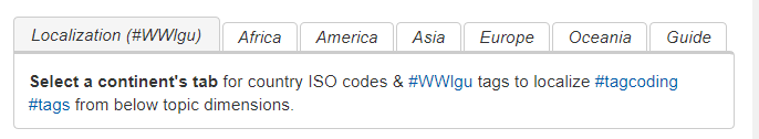
The ISO country codes provide a first means for localizing the international coding hashtags. For these codes we provide a tabbed table listing countries per continent as part of pages of side-bars.
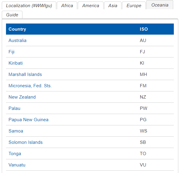
The tab “Oceania” lists these countries:
In the territorial “local government unit” hashtags we combine the ISO country code with numeric, alphabetic or alpha-numeric codes defined by the national statistics organizations for the local government units.
A list of national statistics organizations is provided at the national statistical system page of the Actor Atlas.
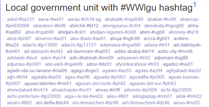
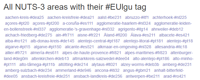
The Actor Atlas contains an alphabetic term cloud with the name and #WWlgu #tagcoding hashtag for major local government units in most countries of the world: Local government units with #WWlgu hashtag.
For the European Union, India, the Philippines, Tanzania and the United States, separate more complete tagclouds have been created.
The localization of #covid19 and #omicron tags
A city’s, county’s, state’s or country’s lgu code can be added to #covid19 or #omicron to create distinct #tagcoding tags to share local news about the fight against COVID-19. Such tags are called #covid19lgu tags.
The #covid19lgu tag is useful in a variety of situations. For instance to update constituencies on the local infection and vaccination numbers, or when local government and others engage on social media to build confidence and trust when the roles of local government and public sentiment varies across jurisdictional lines.
The European Union
The NUTS classification (Nomenclature of territorial units for statistics) is a hierarchical system for dividing up the economic territory of the EU for the purpose of statistical analysis. The current NUTS classification valid from 1 January 2012 until 31 December 2014 lists 97 regions at NUTS-1, 270 regions at NUTS-2 and 1294 regions at NUTS-3 level. Due to the accession of Croatia on 1 July 2013 the NUTS classification was extended by 1 NUTS-1, 2 NUTS-2 and 21 NUTS-3 regions. Full details on NUTS are at the Eurostat website.
Territorial #EUlgu tags on the basis of NUTS are defined at the EU Social Capital wiki and in #Tagcoding in the EU. The EU social capital wiki also includes a NUTS3 tagcloud.
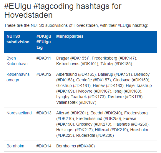
The joint use of both the EU-wide NUTS tags and nationally defined codes is illustrated in the screenshot below, taken from the Hovedstaden page of the EU Social Capital Wiki: Frederiksberg, as part of Byen København, has “NUTS3 tag” #DK011, and it has tag #DK147 on the basis of its code in the Danish statistical system.
India
Territorial #INlgu tags are defined for states, union territories and districts, cities, villages and towns.
The current proposition is to use the coding pattern devised following the recommendation of the Metadata and Data Standard (MDDS) Committee. Its full details are at the Census of India website: Description of Coding Sequence for Location Code Directory.
This is the coding convention:
- A State code of 2 digits within India
- A District code of 3 digits continuous code within India
- A Sub-district code of 5 digits continuous code within India
- A Village code of 6 digits continuous code within India in which the range of 000001 – 799999 is for Villages and the range 800001 - 899999 is for statutory towns.
For instance the village Tamsi has sub-district code 04305, it is part of District Adilabad with code 532, in Andhra Pradesh with State code 28.

The #INlgu tags are as follows:
| State | Andhra Pradesh | #IN28 |
| District | Adilabad | #IN532 |
| Village / Subdivision | Tamsi | #IN04305 |
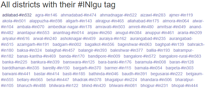
The screenshot below shows part of the district-#INlgu cloud at the India #tags social capital wiki.
Territorial #INlgu tags for states, districts and tehsils are included in #Tagcoding in India.
Philippines
Territorial #PHlgu tags have been defined on the basis of municipal identifiers in the domestic statistical systems.
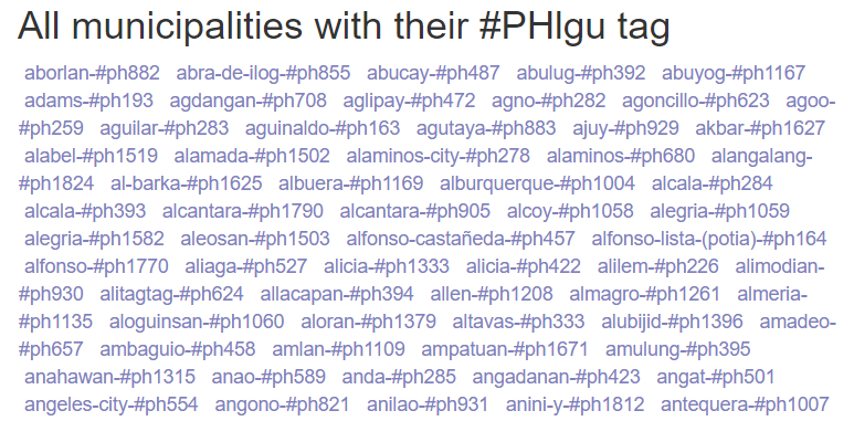
The screenshot below shows part of the municipality-#PHlgu cloud at the #tl2wiki.
Territorial #PHlgu tags for municipalities are included in #Tagcoding Manwal.
Tanzania
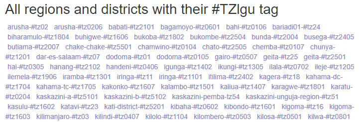
Territorial #TZlgu tags have been defined for all districts and regions of Tanzania.
The screenshot below shows part of the Region or district-#TZlgu cloud at the Tanzania #tags social capital wiki.
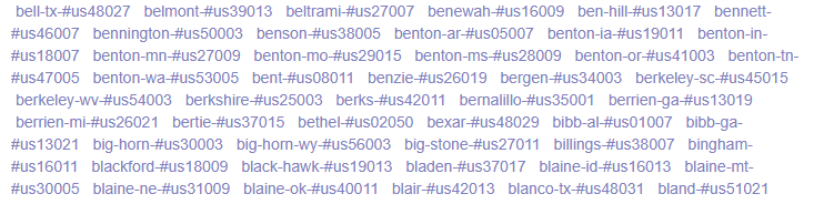
United States of America
State and county #USlgu hashtags have been defined on the basis of the FIPS codes defined by the US census.
The screenshot below shows part of the County-#USlgu cloud at the US #tags social capital wiki.
Territorial #USlgu tags for states and counties are included in #Tagcoding in the US.